 Vencedor da categoria nos países:
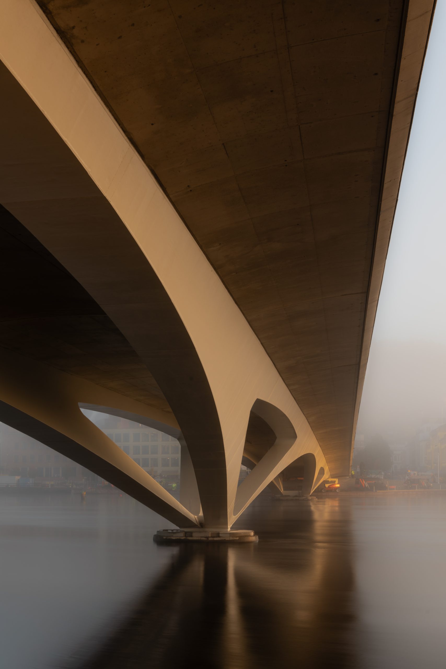
Drammen City Bridge
| Categoria | Projectos de Infraestruturas |
|---|---|
| Ano | 2026 |
| País | Spain |
| Organização | Degree of Freedom |
| Parceiros do Projeto | Saaha, Knight Architects, Norconsult, Asplan Viak |
| Autor | Degree of Freedom |
| Cliente | Drammen kommune |
| Local de construção | Drammen, Noruega |
| Tags | Parametric designConcreteTekla StructuresTrimble ConnectSteel |
Descripción del Proyecto
El puente de Drammen que conectaba los distritos de Strømsø y Bragernes llevaba casi 90 años en servicio cuando el municipio decidió su sustitución. El deterioro severo de sus estructuras de hormigón y el agotamiento de su vida útil, sumado a la necesidad de ampliar la estación ferroviaria central mediante una elevación de las vías de 0,50 metros, hicieron necesario reemplazarlo íntegramente. El nuevo Puente de la Ciudad de Drammen representa un hito para la ciudad, funcionando como eje principal de conexión urbana y evidenciando cómo la metodología BIM, combinada con técnicas avanzadas de modelado paramétrico, permite ejecutar proyectos de infraestructura compleja manteniendo una colaboración fluida entre múltiples disciplinas y equipos internacionales.
Características Técnicas
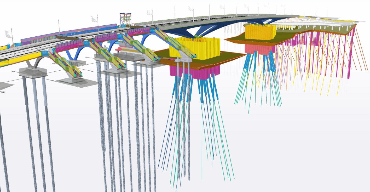
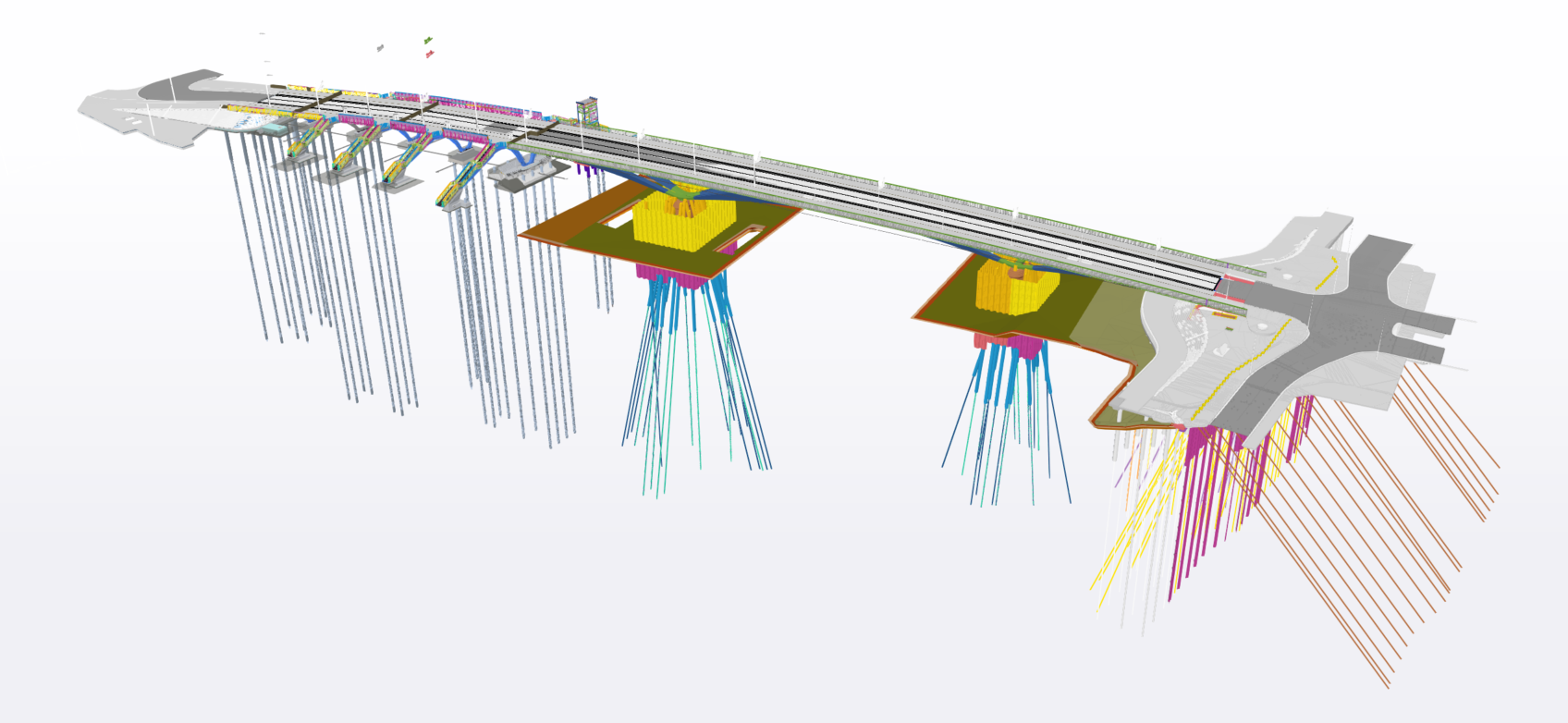
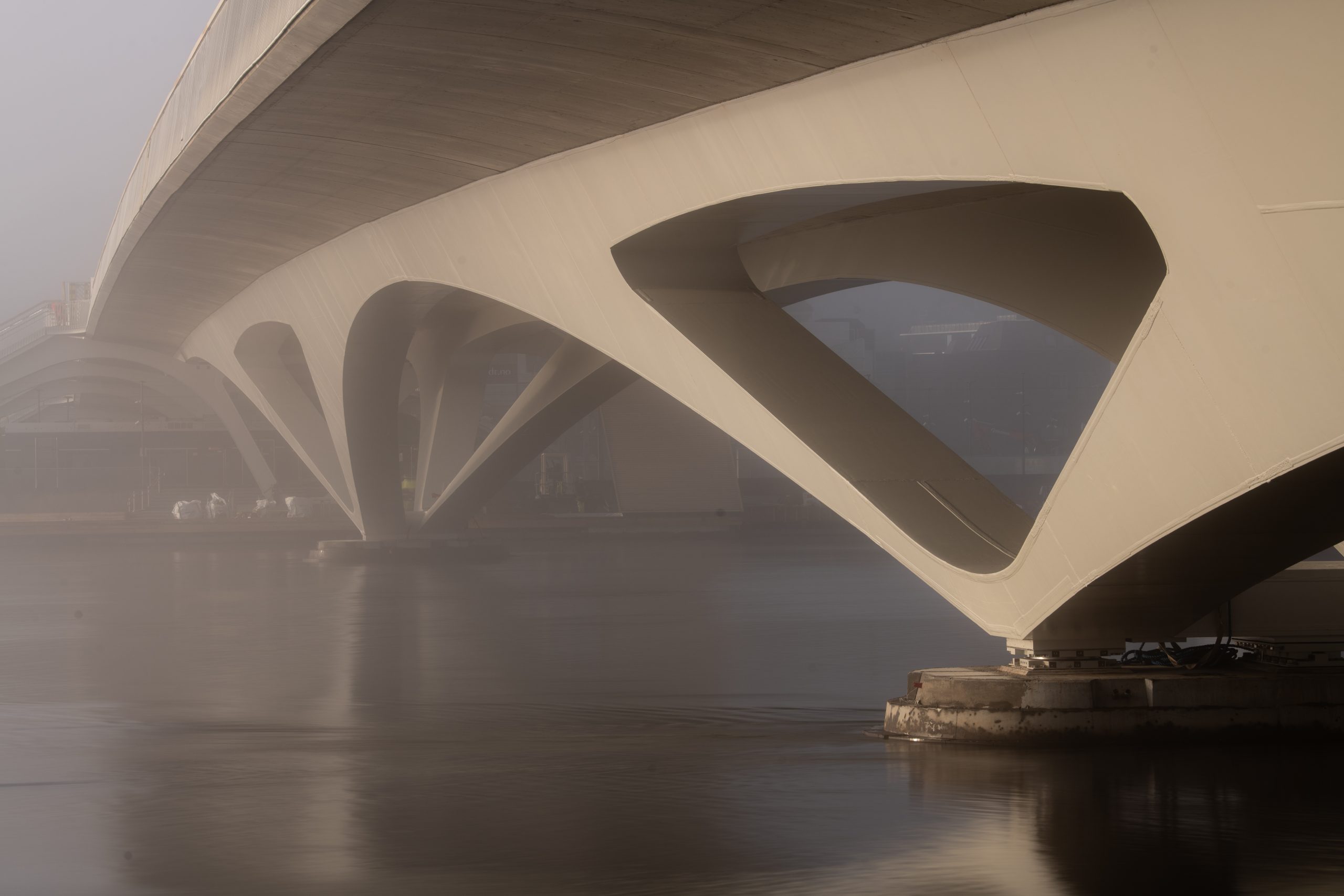
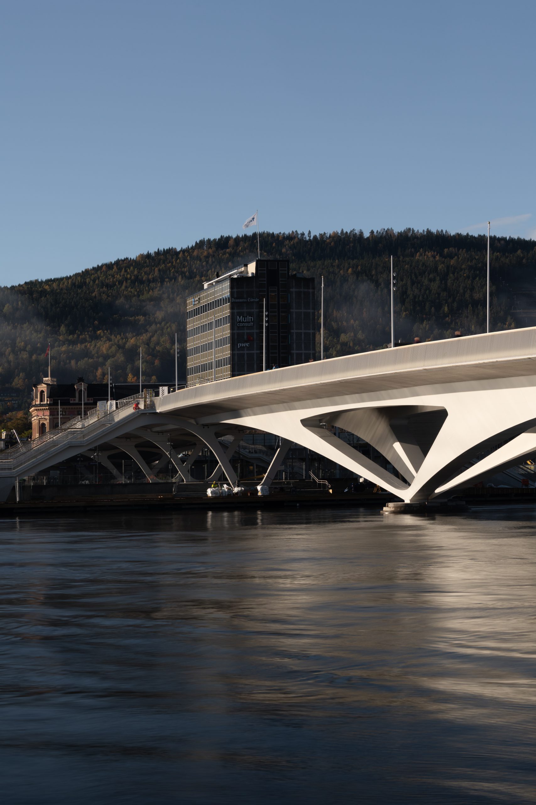
El puente tiene una longitud total de 262 metros, y cruza el río Drammenselva y la estación de ferrocarril. La estructura se divide en dos sectores bien diferenciados: el vano sobre el río y el vano sobre la vía ferroviaria.
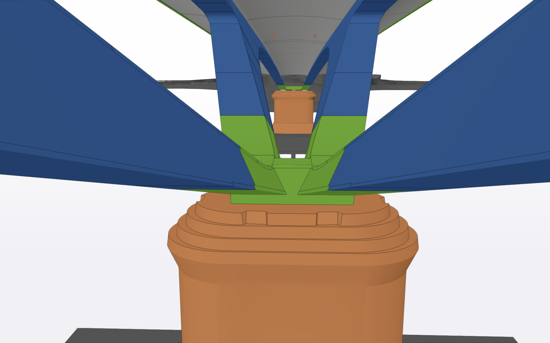
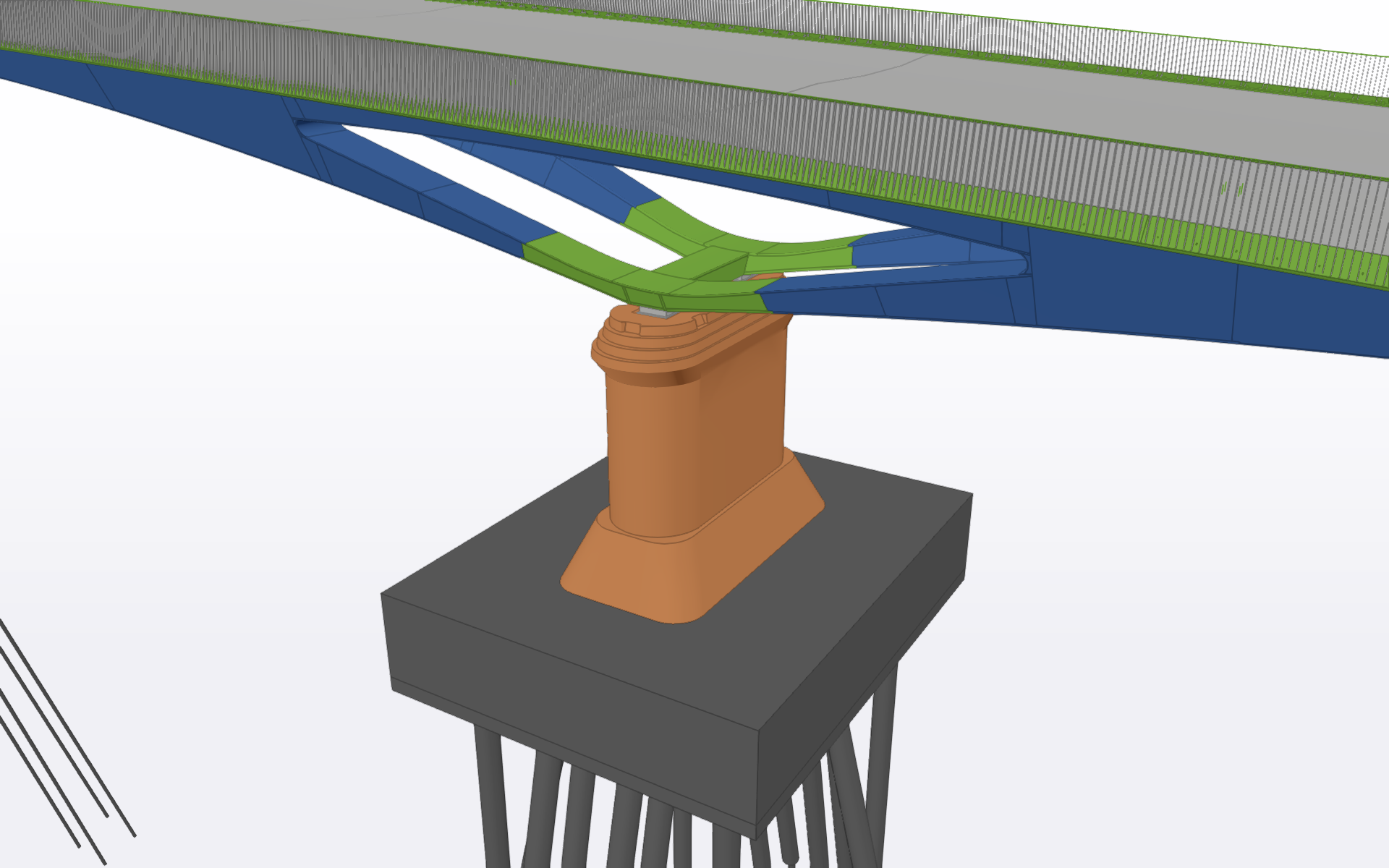
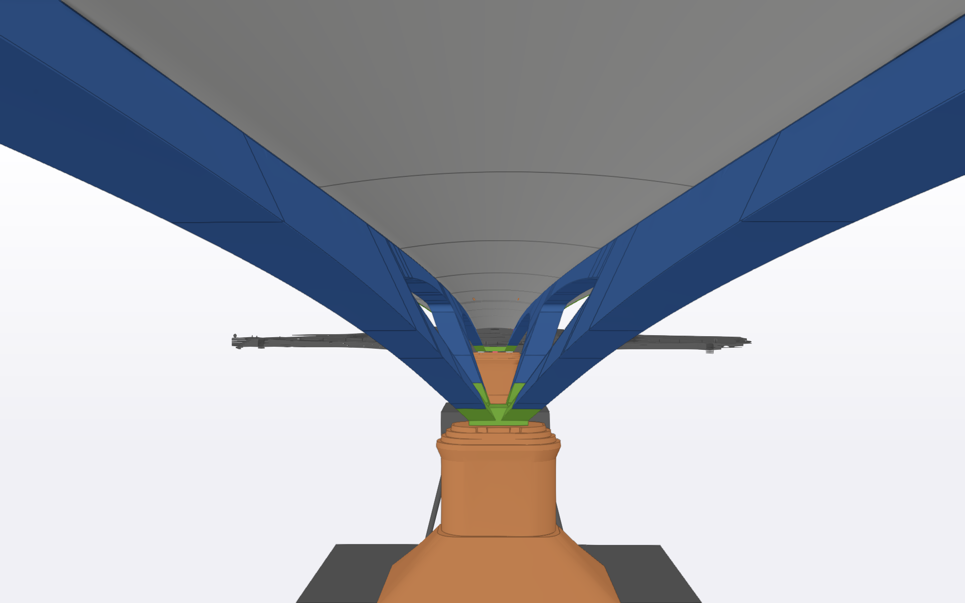
La estructura correspondiente al cruce fluvial se resuelve mediante tres vanos principales de 46 m, 86 m y 42 m de luz, respectivamente. El sistema resistente está constituido por arcos metálicos de acero de canto variable, que transmiten las cargas a un tablero de hormigón armado, el cual actúa como elemento de soporte y distribución. La cimentación se materializa mediante pilotes metálicos hincados hasta alcanzar el sustrato rocoso competente, con profundidades del orden de 75 a 80 m, garantizando así la adecuada transferencia de cargas al terreno.
En la zona correspondiente al cruce sobre las vías, la continuidad estructural se asegura mediante cinco vanos adicionales de menor entidad, con luces comprendidas entre 11 m y 19,5 m, integrados en el conjunto estructural global.
El tablero, de 19 metros de anchura, alberga dos carriles (autobús y taxi) y sendos espacios para circulación peatonal y ciclista de 5 y 7 metros respectivamente. Este enfoque multimodal responde a los principios actuales de movilidad urbana sostenible e inclusiva.
Fundamentos del Modelado Paramétrico
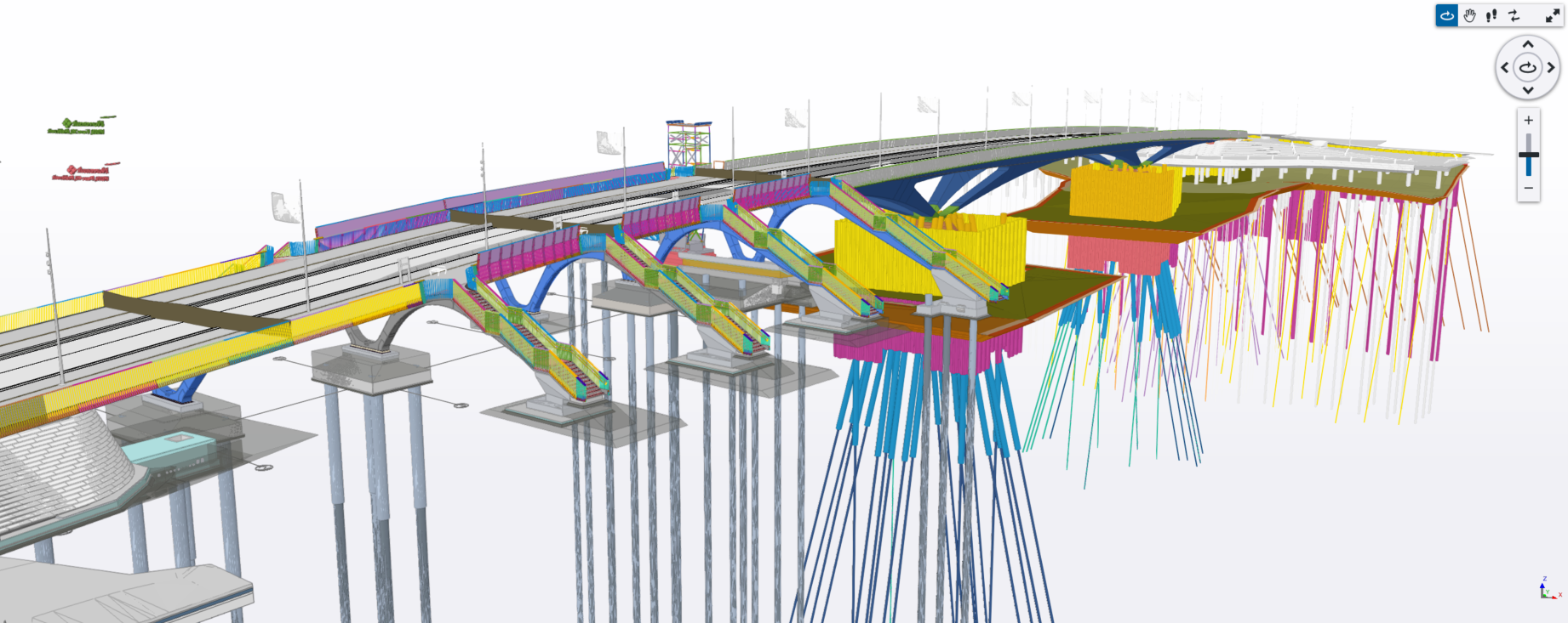
La estrategia BIM del proyecto pivotó sobre el desarrollo de un modelo paramétrico sofisticado de la superestructura mediante Rhinoceros y Grasshopper. No se trató meramente de una selección de software, sino de un compromiso estratégico con la inteligencia geométrica y la flexibilidad operacional.
El modelo paramétrico fue concebido para vincularse dinámicamente a múltiples fuentes de datos externas: el eje viario definido por los ingenieros de transporte, la geometría arquitectónica establecida por los diseñadores, y los sistemas estructurales adyacentes incluyendo cimentaciones. Esta estructura de dependencias multifuente facilitó adaptaciones ágiles durante todo el ciclo de vida del proyecto.
Más allá de la definición meramente geométrica, el marco paramétrico funcionó como herramienta analítica esencial para el equipo de diseño estructural. La gestión de formas tridimensionales complejas en plataformas de análisis tradicionales presentaba retos considerables. El modelo paramétrico generó geometrías intermedias y referencias de coordinación que apoyaron directamente a los ingenieros estructurales, facilitando el análisis de estas estructuras complejas.
Coordinación Multidisciplinar
El proyecto agrupó más de diez disciplinas distintas de ingeniería y diseño: arquitectura, estructuras, instalaciones (MEP), geotecnia, ingeniería vial, paisajismo, topografía y otras especialidades. Los equipos estaban dispersos geográficamente en múltiples países, lo que generaba desafíos de coordinación considerables.
La estrategia de coordinación BIM se basó en un entorno de datos común unificado (CDE). Cada disciplina elaboraba sus modelos en su plataforma nativa, AutoCAD, Revit, Tekla Structures, Navisworks, etc. antes de exportar en formato IFC. Estos modelos individuales se integraban en un único modelo global que servía como referencia.
Este enfoque colaborativo del BIM mejoró ostensiblemente la calidad del proyecto al detectar y resolver conflictos en fases tempranas, reducir errores de diseño mediante la visibilidad integral de los sistemas, y garantizar la alineación entre disciplinas en todas las etapas del desarrollo. Alcanzar este nivel de coordinación mediante sistemas tradicionales de documentación y planos 2D habría sido prácticamente imposible.
Asistencia Continua y Modelado Adaptativo
La participación BIM del equipo no finalizó con la conclusión del diseño. Durante la fase de construcción, los modelos paramétricos y detallados permanecieron como activos vivos del proyecto, continuamente adaptados para reflejar selecciones del constructor, decisiones de suministros y condiciones reales de obra.
Las labores de asistencia técnica comprendieron la obtención y suministro de parámetros geométricos críticos para el replanteo y control topográfico, incluyendo la localización de anclajes y referencias de montaje. Asimismo, se abordó la integración en el modelo de los sistemas constructivos y materiales finalmente adoptados por el contratista, junto con la actualización continua de las especificaciones técnicas conforme a las decisiones de aprovisionamiento. De igual modo, se proporcionó soporte en la definición de secuencias constructivas, facilitando la coordinación entre disciplinas. Este acompañamiento técnico continuo permitió mantener el modelo como un documento de referencia fiable y actualizado a lo largo de toda la fase de ejecución.
El Puente de la Ciudad de Drammen ejemplifica cómo la metodología BIM, unida al modelado paramétrico avanzado, eleva sustancialmente los resultados en todas las fases de diseño, coordinación y construcción. Desde geometrías de complejidad sin precedentes, pasando por coordinación multidisciplinar sistemática entre más de diez especialidades en tres países, hasta asistencia constructiva adaptativa fundamentada en datos as-built, el proyecto evidencia el potencial transformador de una implementación BIM sofisticada. Constituye un referente para la ejecución de infraestructuras complejas mediante procesos digitales colaborativos que elevan calidad, reducen riesgo y generan, en última instancia, mejores resultados para ciudades, agentes involucrados y comunidades.
Project Description
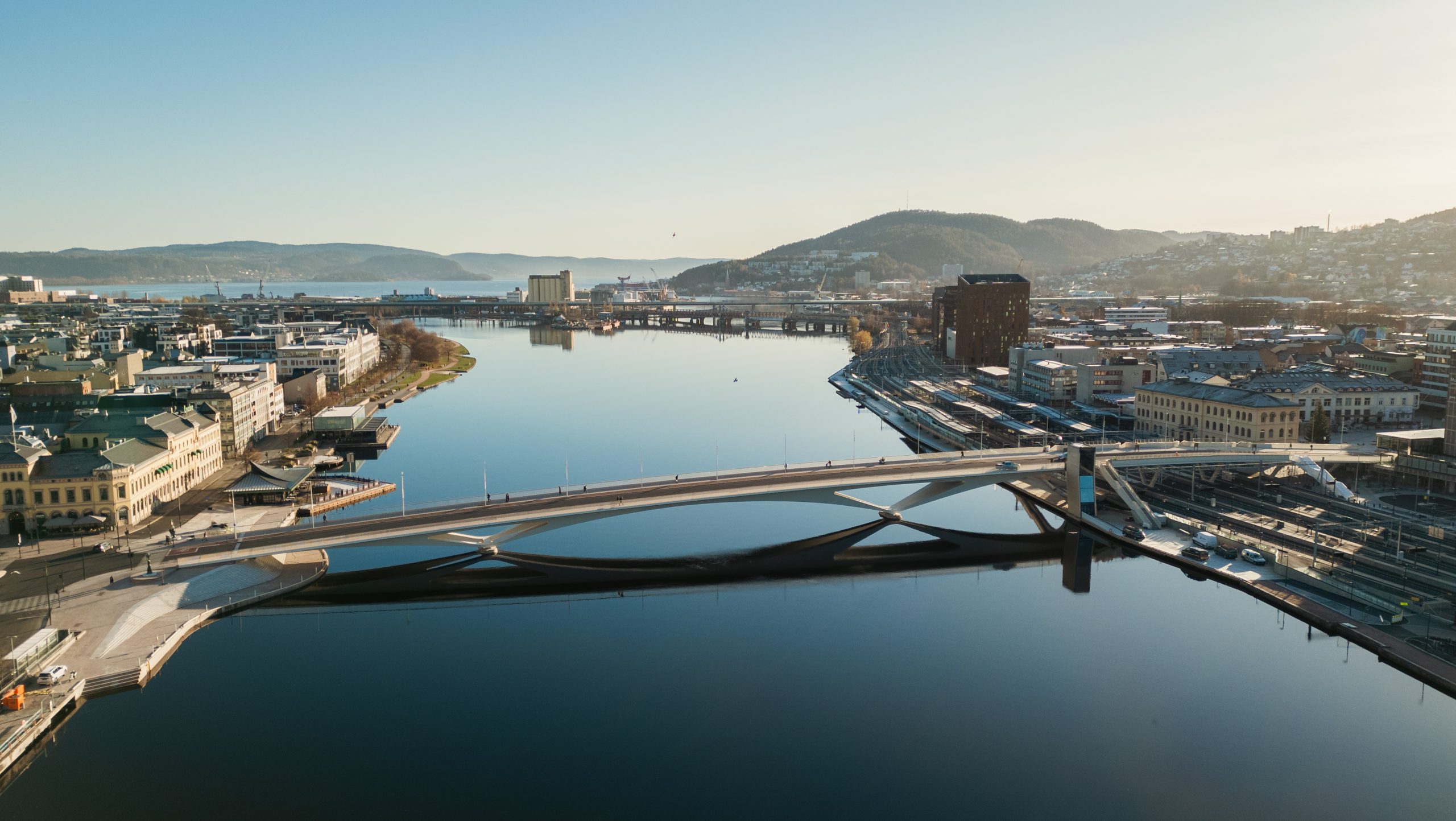
The existing Drammen Bridge, connecting the districts of Strømsø and Bragernes, had been in service for nearly 90 years when the municipality decided to replace it. The severe deterioration of its concrete structures and the fact that the bridge had reached the end of its service life, combined with the need to expand the central railway station by raising the tracks by 0.50 metres, made complete replacement unavoidable.
The new Drammen City Bridge represents a new landmark for the city, serving as the main axis of urban connectivity and demonstrating how BIM methodology, combined with advanced parametric modelling techniques, enables the delivery of complex infrastructure projects while maintaining seamless collaboration across multiple disciplines and international teams.
Technical Characteristics
The bridge has a total length of 262 metres and spans both the Drammenselva river and the railway station. The structure is divided into two distinct structural zones: the river crossing and the railway crossing.
The river crossing comprises three main spans of 46 m, 86 m and 42 m respectively. The structural system consists of steel arches with variable depth, transferring loads to a reinforced concrete deck that acts as both a support and load-distribution element. The foundations are formed by driven steel piles reaching competent bedrock at depths of approximately 75 to 80 metres, ensuring proper load transfer to the ground.
In the section crossing the railway, structural continuity is achieved through five additional spans of smaller scale, with lengths ranging from 11 m to 19.5 m, integrated into the overall structural system.
The 19-metre-wide deck accommodates two traffic lanes (bus and taxi) along with dedicated pedestrian and cycling paths of 5 and 7 metres respectively. This multimodal approach responds to current principles of sustainable and inclusive urban mobility.
Parametric Modelling Principles
The BIM strategy of the project was centred on the development of a sophisticated parametric model of the superstructure using Rhinoceros and Grasshopper. This was not simply a software choice, but a strategic decision to embed geometric intelligence and enable operational flexibility.
The parametric model was designed to dynamically link to multiple external data sources: the road alignment defined by transport engineers, the architectural geometry established by designers, and adjacent structural systems, including foundations. This created a model driven by multiple data sources, enabling agile adaptation throughout the entire project lifecycle.
Beyond purely geometric definition, the parametric framework acted as an essential analytical tool for the structural design team. The management of complex 3D geometries within traditional analysis platforms posed significant challenges. The parametric model generated intermediate geometries and coordination references that directly supported structural engineers, facilitating the analysis of these complex structures.
Multidisciplinary Coordination
The project brought together over ten engineering and design disciplines, including architecture, structures, MEP, geotechnics, road engineering, landscape design and surveying. The teams were geographically distributed across multiple countries, posing significant coordination challenges.
The BIM coordination strategy was based on a Common Data Environment (CDE). Each discipline developed its models within its native platform, such as AutoCAD, Revit, Tekla Structures and Navisworks, before exporting them in IFC format. These individual models were then integrated into a single federated model serving as a shared reference.
This collaborative BIM approach significantly improved project quality by identifying and resolving conflicts at early stages, reducing design errors through holistic system visibility, and ensuring alignment across disciplines throughout all phases of development. Achieving this level of coordination using traditional documentation and 2D drawings would have been virtually impossible.
Continuous Support and Adaptive Modelling
The team’s BIM involvement did not end with the completion of the design phase. During construction, the parametric and detailed models remained active project assets, continuously updated to reflect contractor decisions, procurement choices and actual site conditions.
Technical support included the extraction and provision of critical geometric parameters for setting-out and topographic control, including anchor positions and assembly references. The model was also updated to incorporate the construction systems and materials ultimately adopted by the contractor, alongside continuous updates to technical specifications based on procurement decisions. In addition, support was provided in defining construction sequences, facilitating coordination between disciplines. This continuous involvement ensured that the model remained a reliable and up-to-date reference throughout the execution phase.
The Drammen City Bridge exemplifies how BIM methodology, combined with advanced parametric modelling, significantly enhances outcomes across all phases of design, coordination and construction. From highly complex geometries, through systematic multidisciplinary coordination across more than ten disciplines in three countries, to adaptive construction support based on as-built data, the project demonstrates the transformative potential of a sophisticated BIM implementation.
It sets a benchmark for the delivery of complex infrastructure through collaborative digital processes that enhance quality, reduce risk and ultimately deliver better outcomes for cities, stakeholders and communities.

Deixe o seu comentário
A Construsoft é revendedor autorizado de Tekla Structures e disponibiliza formação, suporte técnico e outros serviços aos seus clientes.
Para mais informações, visite nosso site:
construsoft.ptTekla is a Trimble Company © Copyright 2026 Tekla